As the plane dropped through the clouds toward Mayaguana, I couldn’t stop thinking: this is where my uncle’s story began – and maybe where it started to unravel.
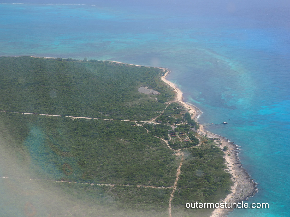
Approaching Mayaguana from the air, what stands out most is how green it looks. Mayaguana, in 1956, would’ve been my uncle’s first assignment. He had some bluster about him, sure – but did he know what he was really walking into? Mayaguana in 1956 wasn’t just a speck in the sea. It was part of something bigger, a U.S. government Missile Tracking Station. What were his first impressions? The island is long and skinny, undeveloped mangroves abound. The airport is flat, surrounded by low hills.

My first impression of the quiet airport; the wind blew in from the sea unimpeded, as if it had not touched a living thing, plant or animal, for many, many miles. Brushing past, it continued on its way, across to the island’s opposite side and passing leeward, out to sea.
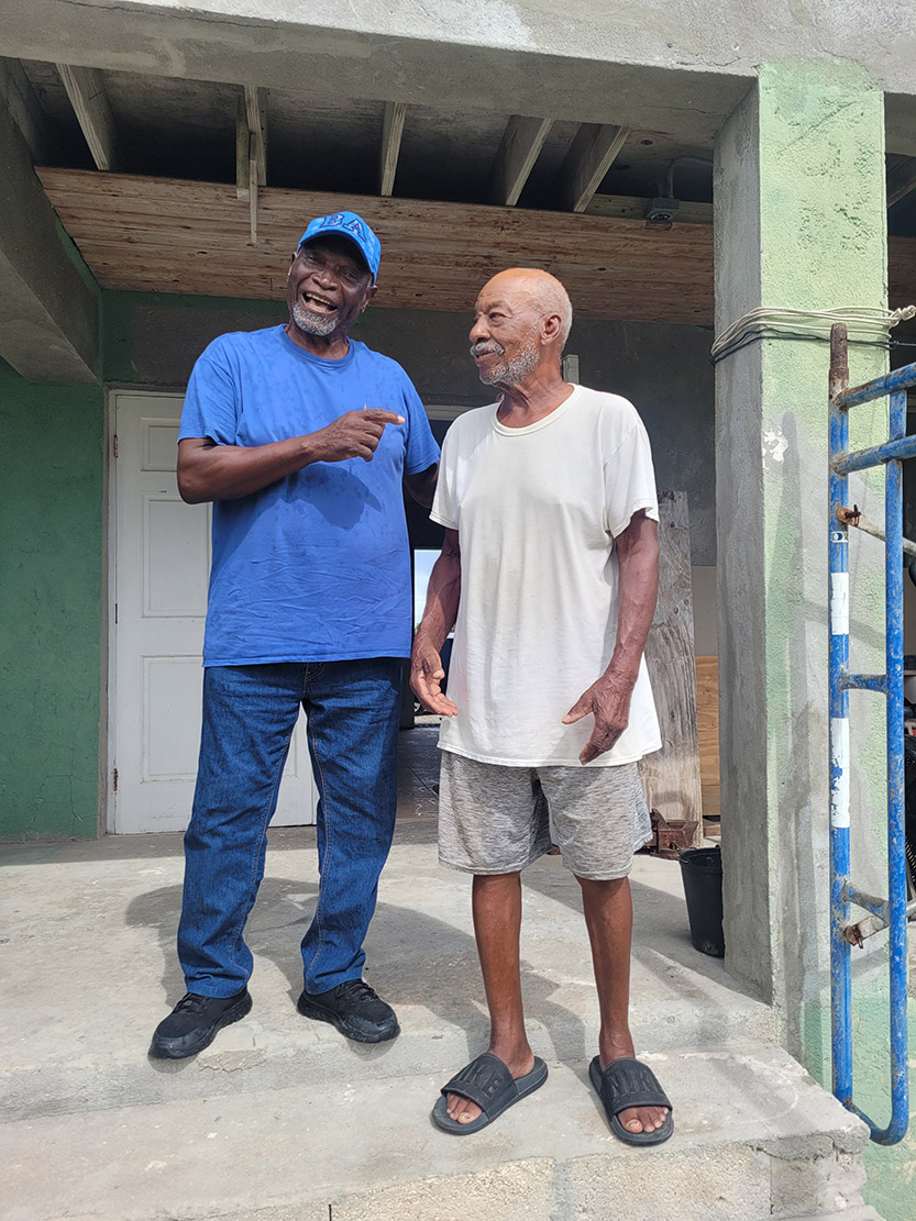
Mr. Huel meets me on the tarmac. He’s got the car I rented and will take me to the place I’m staying. A shack in Abraham’s Bay. Huel is 84, Mayaguana-born and sun-fed, with the kind of robust build and mischievous grin that says, ‘I’ve seen a few things.’ He meets me on the tarmac like it’s a casual Tuesday, car keys dangling from one finger.
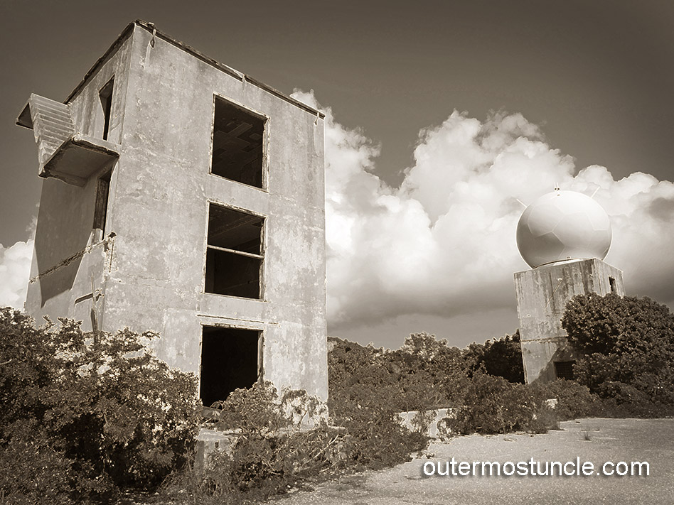
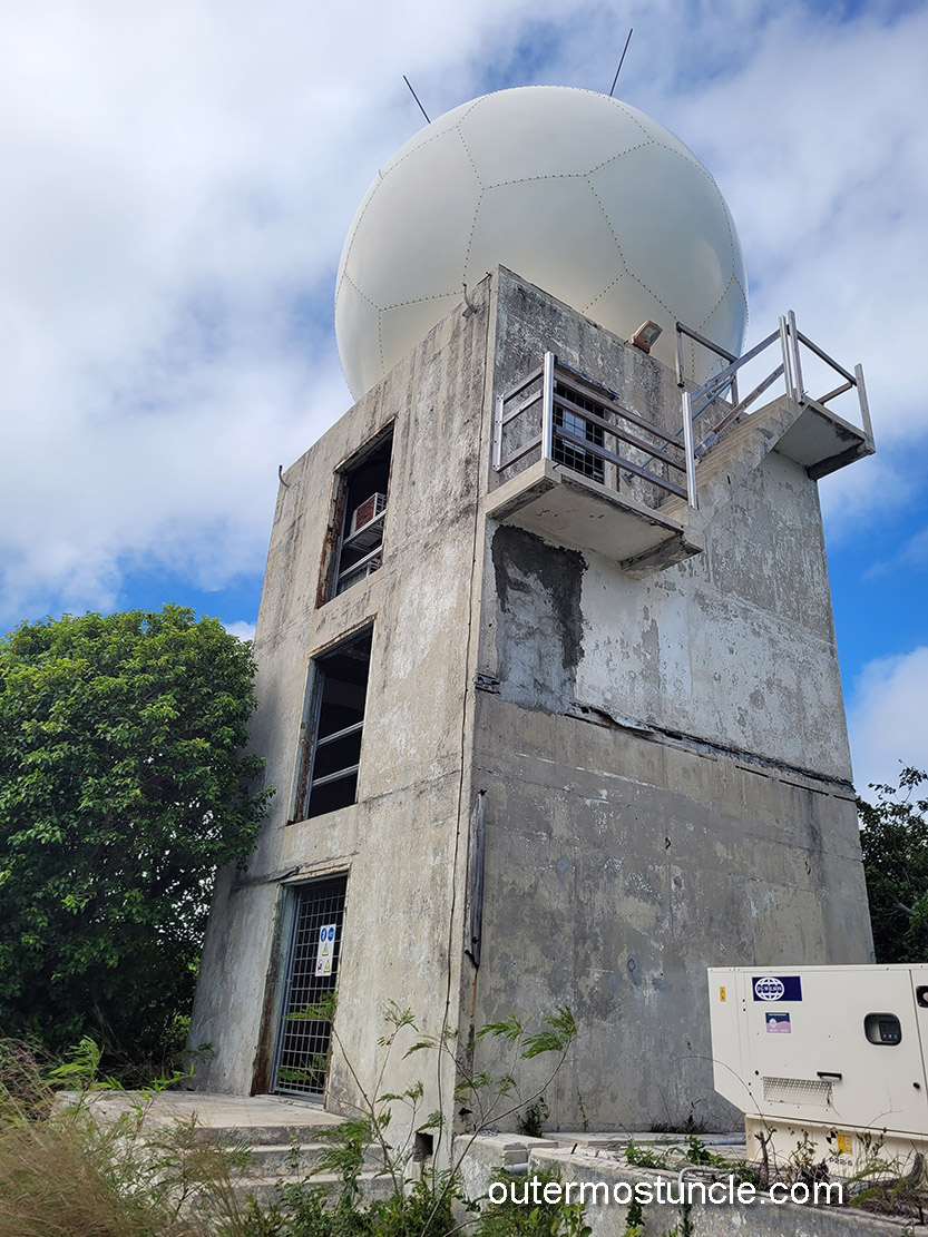
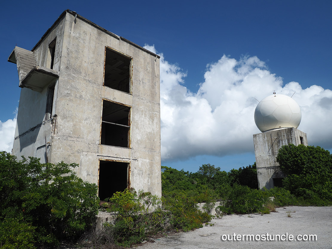
We go to the house. Huel’s car is at the repair shop. We discuss the situation. One car… two people. I could drive him to the shop and he could sit all day waiting. OR … we could tool around the island, me and my own personal unexpected surprise tour guide! We mull it over. [No we don’t.] Let’s do that! We head off back toward the airport, passing the “terminal” and ascending the hill to the south. There it is! Another Central Control. Just like the Central Control on San Salvador, only more intact and cold war-ish. There’s no blue Club Med paint job. A Radome, like an alien sentinel, has been added to the top of the east tower.
We park the car and I walk around the monolith. The silence and the heat – the abandonment- follow me. I go inside. Every footstep sent echoes ricocheting through the empty halls – ghosts of a Cold War operation that had long gone silent but still watched with its hollow eyes.
Rusted cabinets lay open to the elements. I ascend to the second floor, then the third. There’s an access that’s wide open to the sky and missing a door. I look out and see death stairs. It’s unlike me to turn away from possible adventure but those stairs, hanging out in the open air … that concrete below looks like it would be painful. A solid “NO”.
Back at the car, Huel has something important to show me. We drive a short distance to a monument. The obelisk shaped monument commemorates the recovery of the nose cone from a Thor missile, launched in 1959, that captured the first color photographs of Earth from outer space.
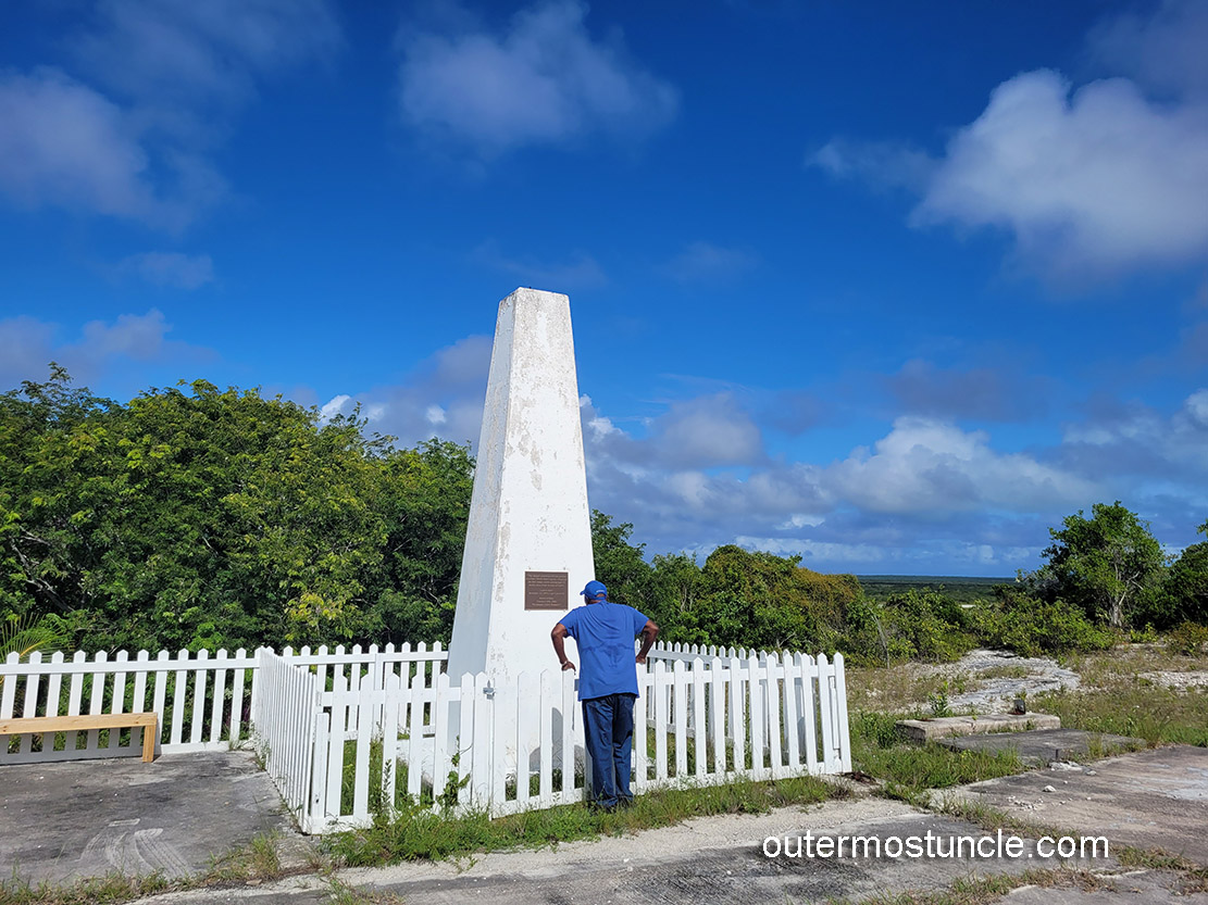
Wow-o. I have to wonder, who visits this monument? Though tourism is important to Mayaguana, there certainly didn’t seem to be much of it going on.
Huel was a kid when the military base and tracking station were located on Mayaguana. His brother worked on the base and he helped him transport laundry. He was about ten years old and would catch a ride in an Army Jeep. “They were these big, tough guys, you know?” He said, flexing his arm.”
Huel becomes engrossed in my book of Bill’s pictures. He recognizes Curtis Creek. “The little island and the deeper current, just here…” he says as he runs his finger along the photograph, adrift in his memories for a moment.

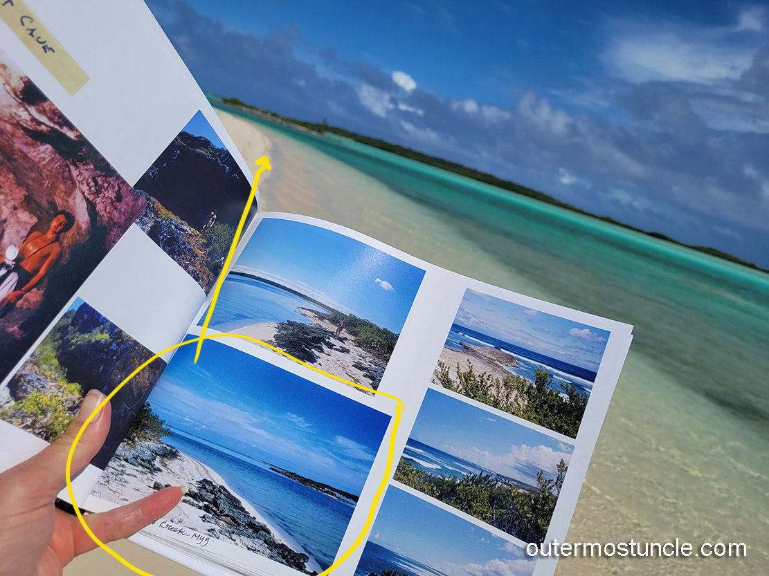
He recognizes the “Taylor residence”. We drive over to the Pirate’s Well settlement. I would never have recognized the spot, but sure enough. “They’ve moved the road back since then.” he says.
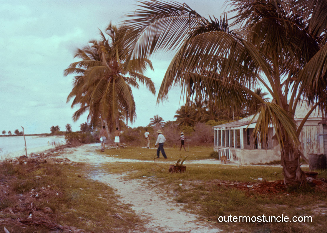

In the early morning before dawn, I step out my door. The air is still and muggy. The only sound, roosters crowing. The incessant mosquitoes seemed to have calmed a bit. I step into the intersection. As I start panning a video, something sparks in my mind.
This scene –
-is THIS scene.
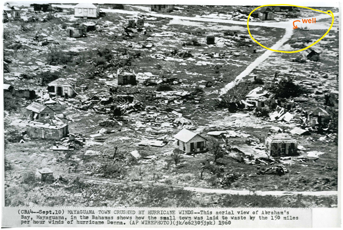
I was carried back in time 66 years. “This is it. This has to be it.” I said to the now surreal predawn air. It became apparent in that moment, Bill’s slides of his time on the Eastern Test Range have burned into my brain. That rustic intersection epiphany was just one of many I’d simply stumble upon.
Later, Huel agrees. The intersection is the same as the one in the picture. He remembers the buildings that used to be there.
I find an aerial photo of hurricane Donna that came through in 1960. After that, they must’ve straightened the road. This was the place.
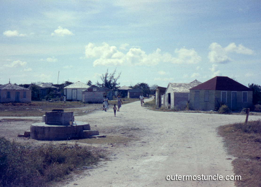
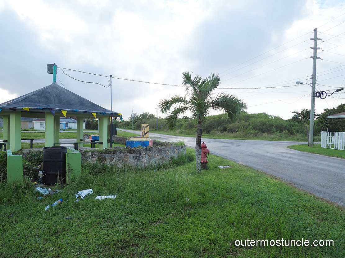
The place I rented was in the Abrahams Bay settlement. This place was at the [now straightened] crossroads. Directly across the street is a structure referred to as the “Well Shack”. It is a place where folks congregate. I’m told it’s a place to hold picnics and gatherings. When picnics and gatherings aren’t being held, however, it is place where men hang out and, for the most part, smoke dope and fall asleep. But, as it turns out, these are very helpful men. This intersection sees about 6 cars a day – on a busy day. So they hang out on this quiet corner – across from my rental house. They observe. They have opinions. They weigh in.
Voices from the Well Shack:
I drag the driveway gate inward. “The gate swings out.” A voice from across the road says. I prove to him that it does not.
Another day, I try to wash a load of laundry. The machine, which is outside, doesn’t work. “The washing machine needs to be plugged in.” Says a voice from across the road. The well shack.
Waiting outside for the person to come fix the wifi. “She’s on her way.” says a voice from the well shack.
Each time, having a just-ask-anyone moment, I nod my head. Give a little wave, gesturing acknowledgment. “Thanks”, I say.
Compared to Mayaguana during the 1950’s, San Salvador Island was one raucous good time. My questions regarding children of the men stationed here are met with knit eyebrows. Quizzical looks. At first I tried to decipher if it was a taboo subject? Honestly, I now think it just didn’t go down the same way here as it did on San Salvador.
It seems to me there are way more men than women on this island. I ask around. Yes. They say. That’s true. Some had not thought about it before, but they agree. Winnie, who pumps gas at the one and only gas station, said, “The women tend to leave. The men? They generally stay.”
I spent a few days, on my own and with Huel, generally tripping around the island. There’s so much more to say about Mayaguana’s intriguing sites and the people I met there. (AND the food at Mel’s!) I’ll talk more about the island later.

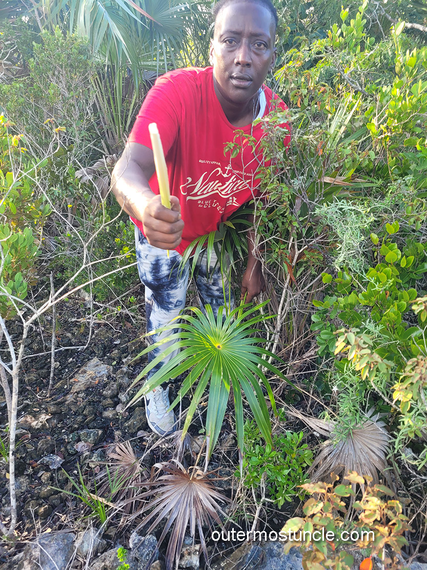
I wanted to find the “bat cave”. On my final day on the island I met up with Marissa, a local adventure tour guide. She showed me the trail and lead me through the brush. Marissa out front, talking, talking. Me behind, carrying all my shit, sweating. Hair sticking to my face and getting in my eyes. Marissa is too young to have been around during the time of the missile tracking station but she knows about it. In fact, her godmother was there and remembers it well. She said, “The Americans show up and they ask, ‘Where’s your women?’ like we’re Africans or something.” I ask her about the ratio of men to women on the island? She considers the question. “Come to think of it, yes. There are more men. Being a lesbian, I am aware of every woman on this island.” she laughs.


After the bat cave (and a shower) it’s time to go.
BahamasAir flies a lot of French ATR42-600 commuter planes. Though between-island flights don’t have assigned seating, the flight crew is diligent regarding passenger placement. As you board at the rear of the plane, a flight attendant instructs, “Take any seat on the right [or left] between rows – and -“. Equalizing the weight side to side and front to rear. They weight and balance geniuses, those attendants. There’s only one class of seating – first come, first served. None of the inter-island flights are long.
I find my seat. It’s a long while before actual take off. I stare out the window and have this hollow feeling of having missed something. I can’t put my finger on it. But I know I missed it.
As the plane tilted north, I looked out over the island and thought: there was something I was meant to see. Something that stayed just out of reach.
Terms of Endearment:
San Salvador and Mayaguana islands are referred to as “out islands” or the “family islands”. I asked around about the difference between the terms. Here’s a recording a few folks in the know, weighing in on the subject:
Teeks Lightbourne, who I met up with in Nassau over a DNA test weighed in, “Out island and family island are the same…we use either one when referring to islands other than grand Bahama or Nassau. Those two islands are considered the city.”
Huel Williamson from Mayaguana said, “Years ago New Providence was referred to as the capitol and the other Islands were referred to as “out Island” which was changed and is currently “Family Islands” they are one and the same; just different reference at different times.
Alex – Airbnb owner at San Salvador says, “I say Family islands. But for most people both family and out Island are monikers they’ve never even heard of!”

Please ask questions and leave a comment. (Some folks are unable to comment – I think it’s a Wordpress thing and I’m really steamed about it.) You can also email me.