
November, 2019. Southeast Michigan. With leftover crusty snow on the ground, some sun and outside temperatures in the 20’s – 30’s, the scene inside the house appeared more like a natural disaster than a home for sale. There had been a bungled estate sale and, in the intervening months, the home my parents’ raised us kids in looked like a tornado had gone through it. It’d been on the market for a while, in a failed attempt to sell it “as is”. I’d finally faced the fact that to make the place sell-able, three floors of stuff needed to be cleared out. The family had picked out what they wanted and I’d set it aside. My parents had moved to an “assisted living” facility (the kinder, gentler term for a nursing home). Over the past few years, I’d brought most of the family photos home with me. By this time, I’d sent Bill’s slides to my cousin, Beth, in Minnesota. Another cousin, Kate, had received Bill’s prints and a box of family letters. Her brother, John, received carvings his dad had gifted my parents years ago. A big box of family photos had gone to a niece in New York. I was sending stuff willy-nilly to extended family, etc. When my mom was there, it was fun to go through these things. Now, they were just things that needed to be sent on their way. New eyes were longing to behold the beauty of these items.
2019 turned into 2020 … The dreaded black cloud was on the horizon. (Ok, I’m exaggerating.) After attending my cousin’s husband’s funeral near Boston in March, I returned to Washington state with a bad case of Covid. This was before they knew what to do with ‘rona-stricken folks. At the hospital, I was treated for pneumonia and sent home … to sequester myself in the upstairs bedroom. And then something juicy happened. My cousin, Kate, emailed saying she was “on pins and needles”. She had been doing research on that Ancestry site and had come across the government report on Uncle Bill’s disappearance! (Uncle Bill! The old dead guy!) My initial phone perusal revealed that this was going to be good.
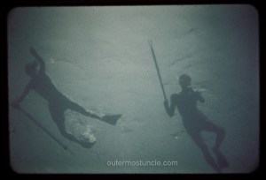
She’d sent 43 pages in a .pdf file. Most of them seemed to be duplicates of the same notes. However, a crucial revelation emerged: Bill’s disappearance occurred near Cockburn Town, San Salvador Island, Bahamas, accompanied by another diver, D. J. Diehl. Who was this D. J. Diehl guy? Skimming through the pages on my phone was far from ideal and, even through my constant coughing and hacking, it was too fucking interesting to stop. I summoned my staff (Bob) to bring me my laptop. Naturally, we went through the whole Covid rigmarole – he’d set the item outside the door and retreat to a safe distance … I’d open the door and retrieve it.
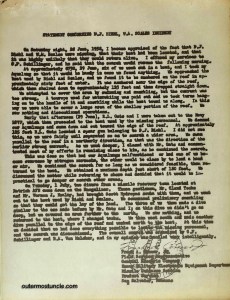
Quite a few of the government report’s pages looked like this:
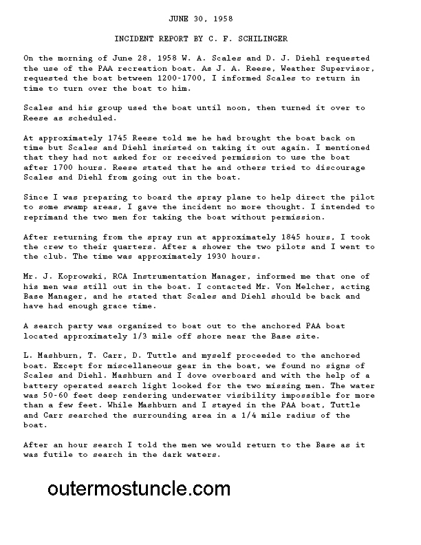
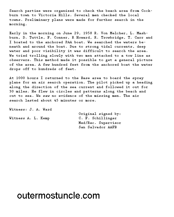
Most of the pages, however, were readable:
Page 1:
Feverishly, I began looking at the Bahama Islands on a map, focusing on San Salvador.
Via the ‘net, I learned that during the 1950’s, San Salvador Island served as part of a network of tracking stations that played a role in the United States’ efforts to advance its missile and space programs. This island, situated in the southeastern Bahamas, became a crucial location for the United States military and [eventually] space agencies due to its strategic positioning and favorable conditions for tracking missiles and [eventually] spacecraft. The Air Force Eastern Range, situated on the east coast of Florida, included Cape Canaveral which was initially used as a testing site for military missile launches.
As I turned the pages of the report, each page added a new dimension to the Uncle Bill mystery. There were eye witness accounts from people who had been there! He and his friend had basically stolen a boat, gone for a dive and vanished into the sea. However, there were some thought-provoking contradictions that stood out to me.
A reading of the Government Report on YouTube.


Please ask questions and leave a comment. (Some folks are unable to comment – I think it’s a Wordpress thing and I’m really steamed about it.) You can also email me.